QRZ Logbook


Saturday, August 11, 2012

Curiosity "UFO" ID'ed?

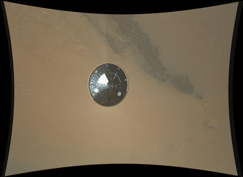
The very first picture from Curiosity on the Martian surface turned the internet upside-down because of an object that looked like an odd formation of some sort. However, the image was just a thumbnail, or a smaller sized image of the original to give viewers a glimpse of the original image, and the resolution was not very good due to the thumbnail's small size. 

Because time was critical due to the pass of Mars Odyssey overhead relaying the telemetry and data before it went out of range of the rover, the smaller thumbnails were programmed to be relayed back to Earth, and only 2 thumbnail-sized images were transmitted before Mars Odyssey went beyond Curiosity's new Martian horizon.

Kaboom!
However, later in the day when more images were sent from the rover's Hazcam, the formation disappeared. Almost instantly the internet was abuzz with hypothetical ideas as to what the phenomenon was, from dust cover debris to UFO's.

The leading theory, however, may be even cooler than E.T.

It is suspected that the object was a dust cloud caused by the crash-landing of the rover's "sky-crane" stage moments after dropping Curiosity onto the ground, and intentionally flying away to prevent it from colliding with the rover. It is believed that, as Curiosity was getting used to its new home and was snapping pictures through its Hazcams, it caught the sky crane slamming into the ground some 2000 feet away!

Once the higher-resolution image was downloaded to Earth, the image resembled more of a mushroom cloud and the direction of the camera coincided with where the sky-crane crashed according to images sent back from the orbiting Mars Reconnaissance Orbiter.

Now the big question is, will Curiosity take a detour to the site to see what the dust cloud might have uncovered?

Thursday, August 9, 2012

Incredible videos from Curiosity's descent

NASA
All eyes are on Mars this week as Curiosity made it's landing in one of the most complex maneuvers ever attempted on the red planet.

As curiosity descended it took video of its landing via the Mars Descent Imager, or MARDI. The video is grainy as the rover is currently sending thumbnail images (the high-res images will come in eventually, albeit slowly since they are so large and so many) to give a sample of what happened on it's way to the surface.

The concave black strips around the border are the result of the fish-eye lens that the camera was using to record the video. Fish-eye lenses allow a much larger field of view to be recorded. The view was inverted to flatten the background and present the video in a format more recognizable to viewers.


Along with the "good bye to the heat shield" video, MARDI also captured the landing. It's abbreviated, but NASA assures us a better video is on its way from the rover as soon as it can be sent.


Now that the high-gain antenna has been aligned with earth, we should be getting a lot more amazing pictures and videos in the upcoming days. I can't wait!

Tuesday, July 17, 2012

NASA gets interactive for Curiosity mission

The Mars Science Laboratory, AKA "Curiosity" is slated to land on Mars August 5. In preparation for the landing, NASA's come up with a slick interactive game for the Xbox 360 game console. 

Using the Kinect controller, you guide the Curiosity thru EDL (Entry, Descent, and Landing) as the rover makes its way to the Red Planet. I downloaded it tonight and ot to play a few rounds. The more accurate you are at each stage, the more points you are awarded. 

You first guide the vehicle through entry into the Martian atmosphere, and, using your body to keep the vehicle in the "center corridor". You'll go through pockets of turbulence and have to move the vehicle back to keep down the center line.


Next, you enter the descent phase, where you must time your movements to the pyrotechnics that deploy the parachute, eject the heat shield and finally remove the backshell, exposing the rover and leading to the final stage, landing.

In the landing stage you'll use your hands to guide the rover down to the target landing area. Accuracy and ease of landing (with the limited supply of fuel) will count as you put Curiosity down following its "7 minutes of terror".

The game also includes a video and some info on the overall mission. The opening screen contains a countdown timer to the actual landing of Curiosity on August 5th.

The game and video are narrated by Al Chen, who is the Flight Dynamics and Operations Lead for Curiosity. 

It's FREE to download (an Xbox Live membership is required, but you do not need to pay for use of the Live account) and available on the Xbox Live site.

And if you have a Twitter account, you can follow them @MarsCuriosity.

Thursday, July 12, 2012

Flat TV antenna steals the show

FlatWave digital flat TV antenna by Winegard Co.
$39.90 at flatwave.tv 
Cable television costs a small fortune these days. No wonder more and more Americans are sticking with free over-the-air TV broadcasts. All you need is a TV and a good antenna, like this one. 
Forget the old-school rabbit ears. The FlatWave is made of translucent plastic about a quarter-inch thick. You can tape it to a wall or window, or lay it flat on a table. Just find the spot in your room that delivers the best reception.
 

Wednesday, July 11, 2012

The monster continues her reign of terror


Here's Amber making a contact with W1BIM during Field Day last month. She had so much fun at the Titanic event in April that Field Day was a natural progression.

If I can tear her away from Karate lessons and cartoons, I might have her licensed before her 11th birthday!

Thursday, July 5, 2012

San Jacinto QRMer arrested again

via KABC Los Angeles
She's at it again!

Irene Levy, KJ6CEY, of San Jacinto, CA was arrested by authorities after shining a laser pointer at the driver of a fire truck en route to a call and on the return trip.

She gained notoriety in 2010 when she used a ham radio to illegally transmit across the fire and police frequencies, including making bomb threats and other erroneous transmissions.

2010 arrest photo
She was on probation at the time of her arrest and is being held on $25,000 bond.

She was licensed in 2009 and as of now her ham radio license has not been revoked by the FCC.

More info on her arrest is available via ABC 7 Los Angeles.

Monday, July 2, 2012

California pirate pays extra for not answering door

Sometimes it's best to just fess up to the crime and take your medicine, otherwise it'll be a lot worse later.

Once California ham radio operator who was illegally broadcasting a pirate radio station on the Broadcast FM band tacked an additional $7k to his FCC fine because he didn't answer the door when inspectors came to check his equipment.
An amateur radio licensee who should have known better was nailed for running an unauthorized FM station northwest of San Francisco-Oakland. The buccaneer only made things worse by failing to let agents inspect the station.
Brian R. Ragan was operating on 104.9 MHz without a license in Suisun City CA. And since he is the licensee of Amateur Radio Station KF6EGI, the FCC said he should have been aware of the requirement to make his equipment available for FCC inspection on request.
That’s why the FCC came down a little extra hard on Ragan. On 2/25/12, they traced the 104.9 broadcast to his garage and heard the station operating there. But nobody answered.
They left a notice of unlicensed operation.
Ragan contacted the office a couple of days later, and admitted he didn’t answer the door because he was afraid to confront the agents.

More on this story here.

Thursday, June 21, 2012

How to blow $6 billion on a tech project

Military Intelligence...an oxymoron if ever there was one...

Via Ars Technica:

In 1997, the Defense Department began its quest for the perfect family of radios: software-defined radios that, like computers, could be reprogrammed for different missions and could communicate with everything the US military used. Digital signal processing could adaptively use available radio spectrum based on the needs of the moment, turning soldiers, tanks, planes, and ships into nodes of a broadband radio-based network.
The goal was to solve radio problems like this one in Afghanistan, detailed by the Center for Public Integrity in January 2012. Soldiers who watched an ambush forming on a ridge nearby found themselves limited by the hugely variable needs of their many radio systems:
They had short-range models for talking with the reconstruction team; longer-range versions for reaching headquarters 25 miles away; and a backup satellite radio in case the mountains blocked the transmission. An Air Force controller carried his own radio for talking to jet fighters overhead and a separate radio for downloading streaming video from the aircraft. Some of these radios worked only while the troopers were stationary; others were simply too cumbersome to operate on the move.
But the program meant to fix the mess, called the Joint Tactical Radio System (JTRS), instead became a massive 15-year software and hardware development mess of its own, involving five sub-programs and multiple multi-billion dollar contracts. It has been a financial disaster for the DOD. Billions were thrown away on technology that will never see the light of day, despite multiple heroic efforts to pull the project back from the brink of disaster.

Read the full article a the above link.

Wednesday, June 13, 2012

Earhart's radio transmissions likely were NOT fake

For decades, pioneer aviator Amelia Earhart was said to have “disappeared” over the Pacific on her quest to circle the globe along a 29,000-mile equatorial route.
Now, new information gives a clearer picture of what happened 75 years ago to Ms. Earhart and her navigator Fred Noonan, where they came down and how they likely survived – for a while, at least – as castaways on a remote island, catching rainwater and eating fish, shellfish, and turtles to survive.
The tale hints at lost opportunities to locate and rescue the pair in the first crucial days after they went down, vital information dismissed as inconsequential or a hoax, the failure to connect important dots regarding physical evidence.
The International Group for Historic Aircraft Recovery (TIGHAR), a non-profit foundation promoting aviation archaeology and historic aircraft preservation, reported new details Friday leading researchers to this conclusion: Earhart and Noonan, low on fuel and unable to find their next scheduled stopping point – Howland Island – radioed their position, then landed on a reef at uninhabited Gardner Island, a small coral atoll now known as Nikumaroro Island.
Using what fuel remained to turn up the engines to recharge the batteries, they continued to radio distress signals for several days until Earhart’s twin-engine Lockheed Electra aircraft was swept off the reef by rising tides and surf. Using equipment not available in 1937 – digitized information management systems, antenna modeling software, and radio wave propagation analysis programs, TIGHAR concluded that 57 of the 120 signals reported at the time are credible, triangulating Earhart’s position to have been Nikumaroro Island.
Read more here.

Tuesday, June 5, 2012

Tornado Tracks

56 years of tornado tracks compiled into the below image:


Click here for more information on the graph.

Sunday, June 3, 2012

Where are they now?

My first QSO on ham radio should be hitting Altair riiiight about............NOW!

Where the signals are...
(click to embiggen!!!)
And just think, the first Marconi signals are even farther out than these!